

That Water Has to Go Somewhere
No simple solutions to Lake Nokomis problems.

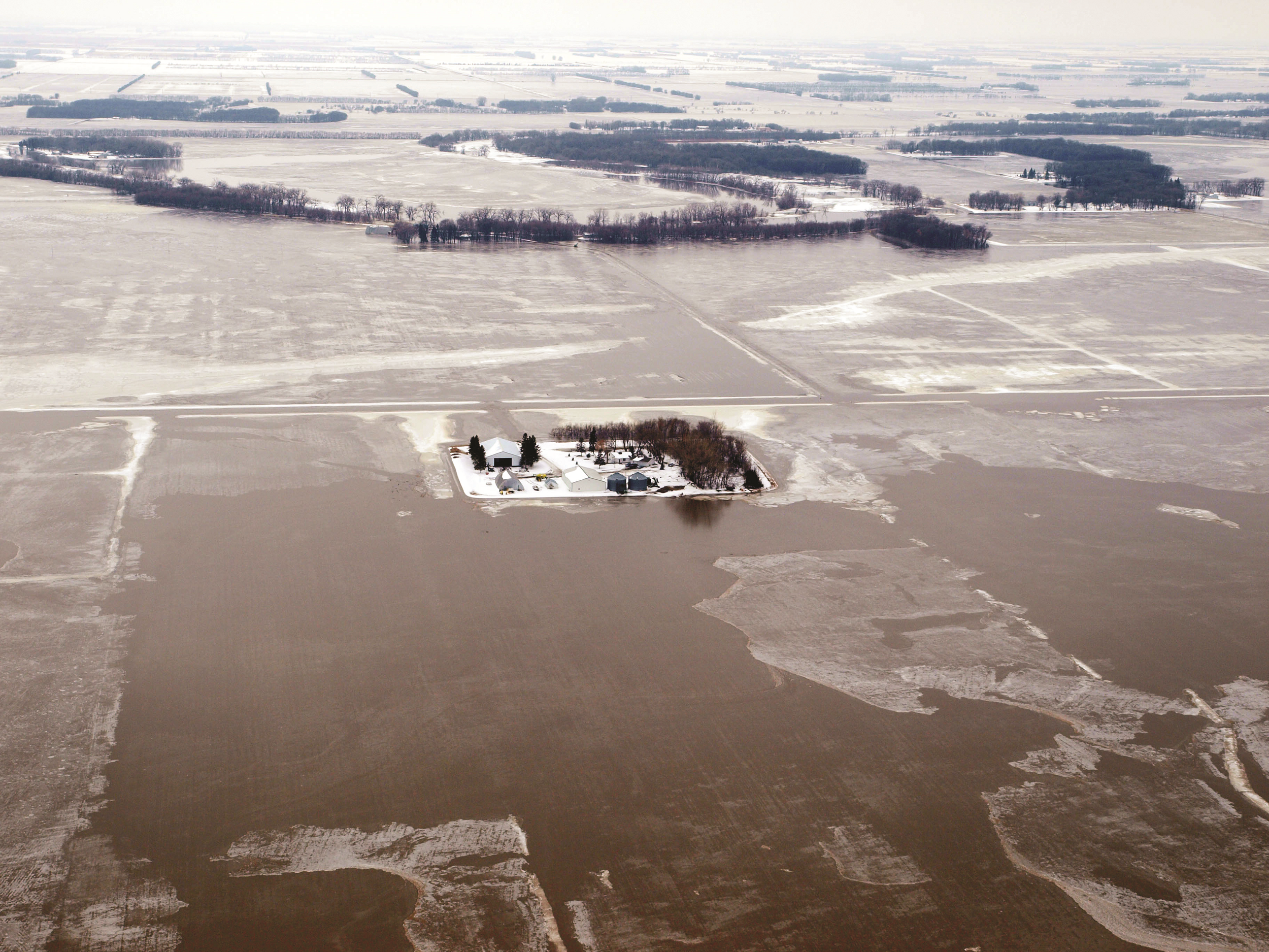
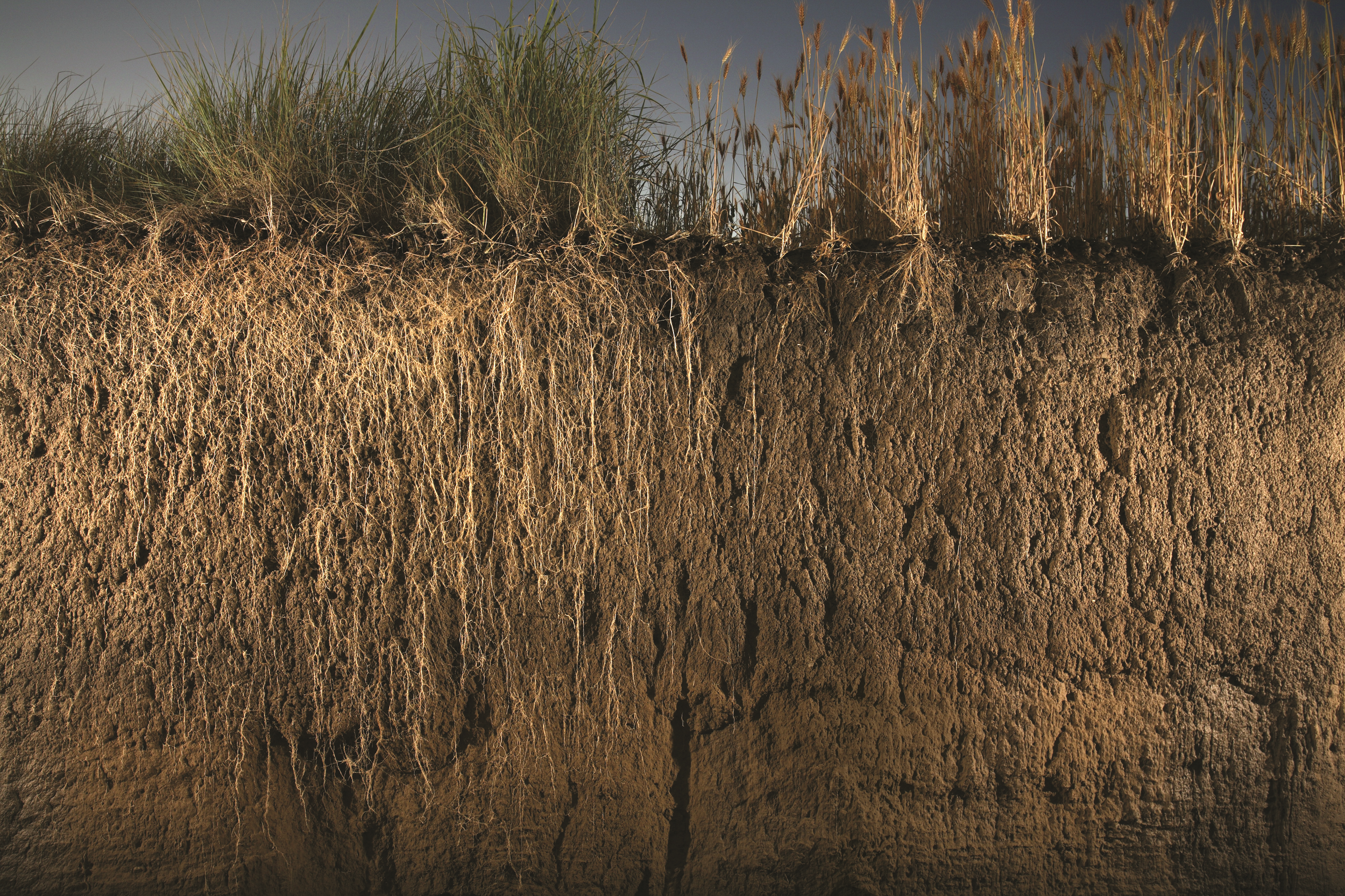
As any Twin Cities gardener knows, the last two summers have been unusually dry in the metro area. But, the past 10 years have actually seen higher than average precipitation—as much as 5 additional inches per year.
“That extra water has to go somewhere,” says John Nieber, a professor in the Bioproducts and Biosystems Engineering department, who researches hydrologic processes and modeling and the impact of land use activities on water quality. Nieber says if excess water is not shed off the surface into storm sewers and eventually into waterways like rivers, the overflow precipitation can end up going into the upper levels of the ground. When that upper level gets saturated, the local water table rises.
According to the National Geographic
Society, the water table is the underground
boundary between the unsaturated zone
of earth and rock and the saturated zone,
where groundwater fills the gaps in rocks
and sediment.
This rise can be good for nature, creating
healthier wetland habitats. But it can also
lead to flooding and other issues that can
be extremely damaging to our built environment, including homes.
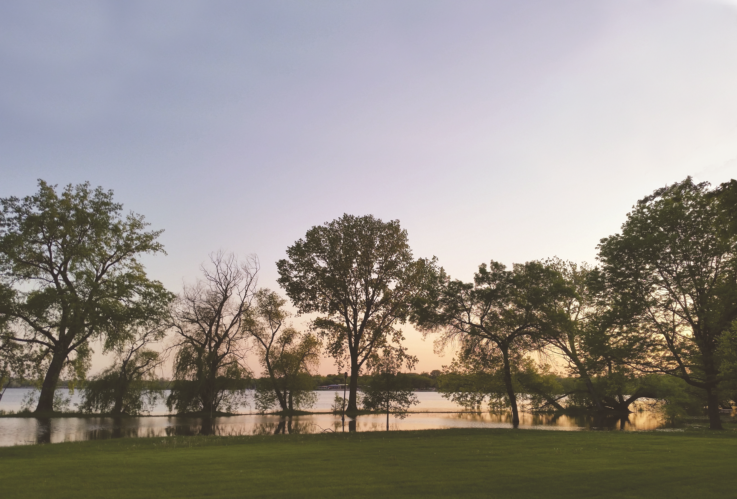
Nowhere is this challenge more evident
in the metropolitan area than in the neighborhoods surrounding Lake Nokomis in
South Minneapolis. Over the last decade,
neighbors began to complain about multiple
water-related issues, including wet and damaged basements, soggy lawns, and
damaged infrastructure.
Nieber says there is a misconception among some that flooded basements in the area are being caused by city officials allowing Lake Nokomis to get too high. Instead, he believes the problem may come from a multitude of issues.
A white paper called the Lake Nokomis
Area Groundwater & Surface Water Evaluation, a joint effort between the U.S. Geological Survey (USGS), Minnesota Department
of Natural Resources (DNR), Hennepin
County, the Minnehaha Creek Watershed
District (MCWD), the Minneapolis Park and
Recreation Board (MPRB), and the City of
Minneapolis, in coordination with the U of
M and other partners, was published in
April 2022. The report notes that different
areas around the lake are being affected by
different issues, all of which are combining
to create problems.
The report says, “During the wettest
seven years on record in the Twin Cities,
2013-2019, property owners southwest of
Lake Nokomis reported water-related concerns to the City of Minneapolis. Concerns
included wet basements, wet backyards, sinkholes, impacts to private sewer lines,
and extended periods of saturated soils in
previously dry areas. Between 2014-2018,
the City of Minneapolis received water
concern reports from 21 property owners
in three areas.
The issues identified in the whitepaper
are multifold. They include the area’s peat
soil, considered a wetland soil, that can
“act as a barrier and prevent rainfall from
draining into deeper levels.” This causes
precipitation to “perch” above the peat.
A second is that the area was originally a
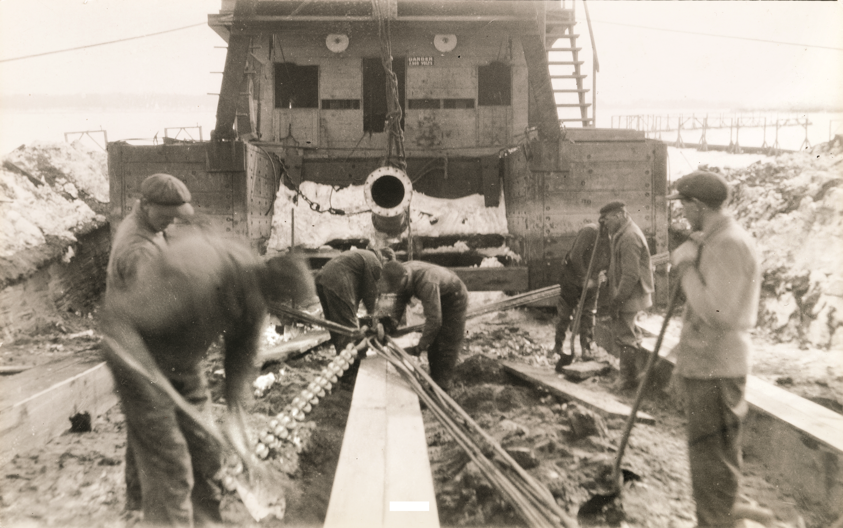
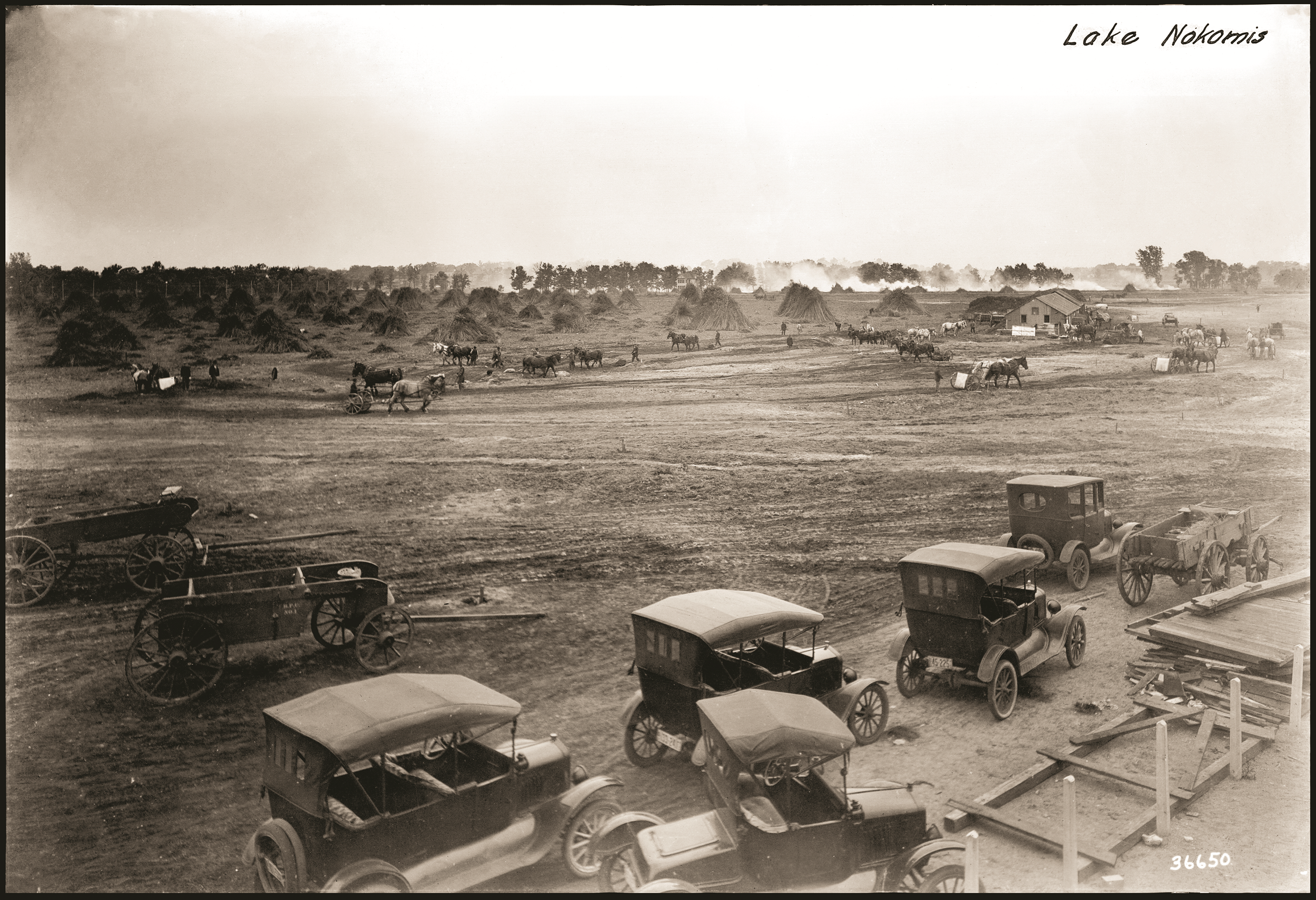
wetland that was filled in prior to development. Third, “Over the course of four years
(1914–1918), MPRB led a massive dredging
project that removed 2.5 million cubic
yards of wetland and peat soils from Lake
Nokomis. This amount is equivalent to
around 250,000 dump truck loads. This
excavated and dredged material was used
to fill adjacent low-lying wetlands, which
increased the total land area by 100 acres
and deepened the lake.”
All this, coupled with record rainfall, may
have led to the ongoing water problems
homeowners experienced.
To further determine the cause of these
high water levels, Nieber is collaborating
with principal investigator Joe Magner
(Ph.D. ’06) at the U of M on a project funded through the Legislative-Citizen Commission on Minnesota Resources (LCCMR),
which makes funding recommendations to
the legislature for special environmental
and natural resource projects.
Working together with the U.S. Geological Survey and the Minnesota Geological
Survey, Magner’s team is mapping out the
subsurface geology of the area, including noting deposits from the last glacial
event, which happened 10,000 years ago.
They are also interviewing homeowners
to get a complete sense of the water
damage that has occurred. They will then
work to educate homeowners about the
multiple causes of the water issues and
offer suggestions for how to solve these
challenges.